How does Measurement Contribute to a Habitable Planet for All?
Last month, CEGA held its ninth annual Measuring Development (MeasureDev) conference on “Mitigating the Risks and Impacts of Climate Change,” in partnership with the World Bank’s Development Impact Evaluation (DIME) Department, Data Analytics and Tools Unit (DECAT), and the University of Chicago’s Development Innovation Lab (DIL). Speakers showcased innovative approaches for measuring and tracking climate-related risk, developing effective responses, and evaluating outcomes in data-sparse environments. Sean Luna McAdams, CEGA’s Data Science for Development Program Manager, shares key insights from the event here.
Climate change is disrupting weather patterns around the world. Look no further than the unhealthy levels of smoke in the Northeast’s skies last week. The impacts on human activity require urgent investments in mitigation and resilience for those most vulnerable. Last month, CEGA, DIL, and the World Bank brought together some of the most innovative social and natural scientists working on this existential challenge to share how they are pushing the frontiers of data collection, for example by using remote sensing technologies, engaging in participatory data collection, and effectively (and meaningfully) integrating different data streams.
A Call for Better Measurement
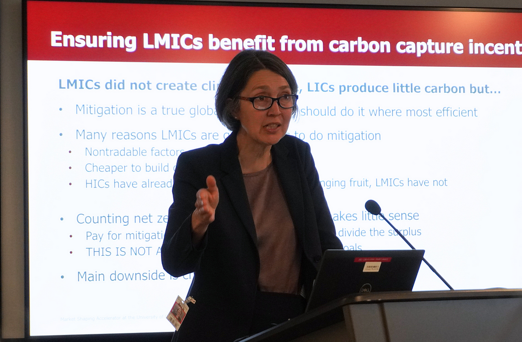
“Mitigation is one of the true global public goods,” noted the University of Chicago’s Rachel Glennester in her keynote address. Indeed, the efforts by one country or group of countries to reduce carbon emissions will have benefits that are felt worldwide. Recognizing that low- and middle-income countries (LMICs) — who have historically contributed little to climate change — nevertheless face growing opportunities to mitigate emissions for the whole planet, Rachel suggested high-income countries could fund highly costeffective mitigation efforts in LMICs. These payments should not be considered aid as they benefit the world and offset high income countries’ damage to the atmosphere. To do this effectively we need scalable approaches to measuring emissions, among many other critical indicators.
Cost-Effective Measurement with Remote Sensing
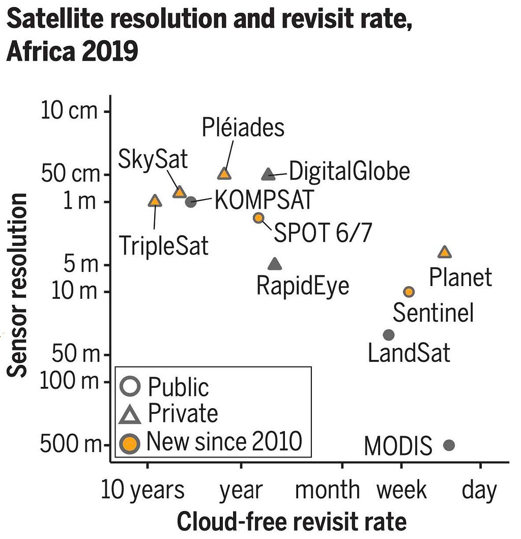
Many speakers addressed the challenge of cost-effective measurement through the use of remote sensing. CEGA Affiliate Tamma Carleton highlighted the promise of satellite imagery and machine learning (SIML) to improve climate management. Her own work on MOSAIKS demonstrates the potential for these data and predictive models to increase the spatial coverage and resolution of survey and administrative georeferenced data, while lowering barriers to access for decision-makers in low-resource settings. Similarly, Dieter Wang showcased how higher resolution and frequency satellite imagery alongside cloud-penetrating sensors can improve estimates of how well conservation policies in the Brazilian Amazon are preventing deforestation. Better measurement in this case makes it possible to reward governments through bonds whose rates are tied to mitigation performance. Kangogo Sogomo discussed a novel approach that leverages satellite imagery to predict maize yields at a finer scale with less computational resources.
Of course, remote sensing is not just limited to satellites and can inform adaptation and resilience alongside mitigation. Samuel Seo, for example, compared measurement strategies for methane emissions from a large, unmanaged landfill in Dakar, Senegal by collecting data using human enumerators, drones, and satellites. Across the board, these measurements suggest that current approaches used by the IPCC underestimate total emissions from these sites by more than half. Bridget Hoffman instead used low-cost air pollution sensors along bus routes and within buses in Dakar to understand the effects of an infrastructure project on air quality. Drones, stationary sensors, and other instruments can all provide rich data at scale to improve the evaluation and monitoring of climate mitigation and adaptation strategies.
The Role of Participatory Data Collection
Researchers and climate practitioners not only think creatively about the sensors they use to collect data, they also innovate data collection and its infrastructure to make it more participatory. Kangogo Sogomo noted increasing mobile phone use and internet penetration across the global South suggesting, “climate action is urgent… there is still an opportunity for having participatory methods [for data collection].” Tom Bewick, for example, has trained indigenous communities in Africa and Latin America how to collect georeferenced data on planted trees to improve the monitoring of their growth and local collective governance. Similarly, Kenneth Mubea, who works to conserve mangrove forests, discussed how his research assembled teams of students to work with local communities to collect georeferenced data. Participatory approaches can extend to model validation, as with the case of Alejandra Mortarini. She worked with organizations that have long-standing relationships with communities living in informal settlements in Honduras to help validate the outputs of the predictive model and calibrate it to improve its performance. By incorporating local actors into data collection efforts, we can increase its frequency, provide greater access, and contribute to a local culture of evidence-use.
New Approaches to Data Integration
A third strategy to make data collection cheaper and more effective relies on exploiting efficiencies generated by integrating different data streams. The World Bank’s Stéphane Hallegatte stressed the opportunity of integrating different data sources in his remarks.
“We have all this fantastic progress in measurement with remote sensing and big data, we have these household surveys that are playing an absolutely critical role to measure what we are doing and to prioritize,” said Hallegatte. “One of the big challenges is to make them completely interlinked and to flow smoothly from the spatial to household surveys, and have household surveys that can be more flexible when there is a shock that can use data coming from satellites to maybe focus and do dedicated surveys in places that have been affected by a shock.”
In particular, Hallegatte stressed that traditional measures of vulnerability may lead us to miss some individuals who may be critically underprepared to face the “long tails” of climate shocks. Adaptive research designs can help us understand which interventions work best in particular contexts and communities, improving our understanding of how climate systems affect those who are socioeconomically and environmentally most vulnerable and how we may build resilience together.
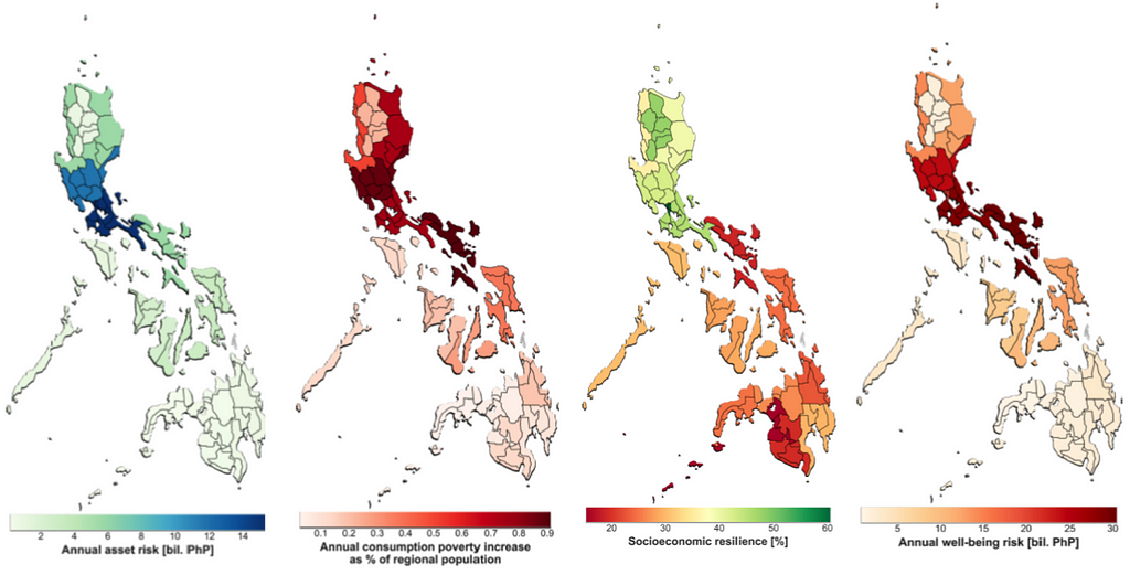
Paola Agostini, Mohammed Basheer, and Erwin Knippenberg simulated physical and social systems in their research designs. These simulations enabled each of them to estimate new quantities of interest, like the decision-space of negotiations for potential dam designs in the Nile River Basin, the cost-per-benefit of different land restoration interventions in Tajikistan, or the percentage of the population at risk of falling into poverty due to weather shocks in Afghanistan. Ben Brunckhorst showed how the incorporation of weather predictions unlocks the possibility of anticipatory cash transfers with demonstrable effects on household resilience to flooding in Bangladesh.
Through better measurement we can improve our collective efforts to meet the challenge of climate change. As Hallegatte reminded us in his keynote remarks, how we construct these measures of impact fundamentally affects what regions, communities, and interventions we prioritize. A critical part of this effort will be to leverage measurement strategies highlighted during MeasureDev 2023 to channel resources to the places and communities where interventions to mitigate and adapt to climate change will have the greatest impact. In so doing, measurement can contribute to a more equitable future by incentivizing green investments in LMICs.
How does Measurement Contribute to a Habitable Planet for All? was originally published in CEGA on Medium, where people are continuing the conversation by highlighting and responding to this story.

